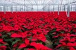
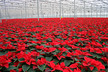
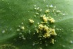
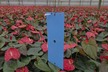
Mapping of pests and diseases in horticulture is still often a manual, inaccurate and inefficient process relying on paper-based analysis and individual knowledge.
Farms use a team of scouts to collect data on many hectares of greenhouses and measure the effectiveness of pesticide spraying.
Using these manual processes to analyse data is complex enough in one greenhouse – let alone 20 or more, all of which will have their own unique factors impacting pest and disease control such as temperature, moisture and risk of physical damage.
Advanced GPS mapping and analytics tools are readily available to digitise a large portion of pest and disease mapping, tracking and control. Here are three key benefits of using technology.